Catalina Island, located off the shores of the Rancho Palos Verdes Peninsula in Los Angeles County, is a great place to visit for a day trip or an overnight. Not only is it easy to get to from Los Angeles and Orange County, it’s like visiting a world away from it all – a beautiful escape with a temperate marine climate.
When you visit Catalina Island, one of the best ways to get acquainted with its natural beauty is to hike its many trails. The hikes available on Catalina Island feature gorgeous views, wildlife and plant life, and fascinating history about the island and its people over the centuries.
» Explore The Perfect Catalina Island Day Trip: 8 Great Things To Do.
Some of the most popular hiking spots in California can be found on Catalina Island. There are dozens of hikes for all levels, from easy to difficult, and short to long. Please be aware that these hikes may be dangerous for the unprepared, so be sure to pack the appropriate provisions, plenty of water, and take all necessary precautions.
» Find the perfect hiking clothes. I love these weather resistant, breathable shorts by Arcteryx (for women | for men) paired with a light performance shirt (for women | for men).
Getting There
The most popular way to get to Catalina Island is by ferry. You can catch the Catalina Express ferry to the island from three ports: San Pedro, Long Beach and Dana Point. There are up to 30 departures per day and it only takes on hour to reach the island. They run year round. Or you can get the Catalina Flyer from Newport Beach to Avalon.
From Los Angeles, you can head to any of the first three ports. Long Beach and San Pedro are both about 25 miles from central LA. Dana Point is an hour drive south from LAX.
Another way to reach the island is by plane, but that’s obviously quite a bit more expensive. Helicopter service is available from Long Beach and San Pedro to Avalon. You can also charter a private plane to land on the island.

Ferry Fares
Currently (2022) the roundtrip fee from Long Beach or San Pedro to the main port in Avalon is $83.50 for adults, $76.50 for seniors, and $68.00 for a child. You can take a bike or surfboard with you for an additional $7. The fee is slightly more from Dana Point. You can also go from San Pedro to Two Harbors port for around the same fee.
Getting Around on the Island
You can’t drive to or on Catalina Island. So be prepared to leave your car behind. Once you get to the island, you can get around on foot, on the public bus, or by taxi. The residents of the island mostly get around in golf carts.
In Avalon, the Garibaldi Bus is $2 per ride and it runs from 8am to 6pm every day. It reaches each stop at 40 minute intervals.
If you’re flying in, you can take the Catalina Island Conservancy Wildlands Express Shuttle to get to Avalon or Little Harbor.
Hiking Permits
If you’re only planning to do a day hike on the island, you will need to get a permit, which is free. If you’re camping overnight on a multi-day hike, your camping reservation serves as your permit. Be sure to have it on you at all times while hiking.

Hiking Etiquette & Tips
It is essential to always be prepared for hiking by wearing the appropriate clothing, packing the right gear, and being aware of hiking etiquette whenever you’re out on the trail. Here are some of our tips for ensuring your hike is a good one:
- Park only in designated spots, not off-road or in unpermitted areas.
- Wear the appropriate clothing for the time of year – bringing a layer in case of sudden temperature changes. Be sure to wear sturdy shoes (flip flops are never a good idea).
- Do not feed or approach any wildlife. Be aware there might be bears mountain lions, bobcats, or rattlesnakes on the trail.
- Bring a good amount of water, some food, and sunscreen with you.
- Never leave trash behind.
- It’s best not to hike alone, but if you do tell a friend where you’re going and when to expect you back.
Catalina Island Hiking Trails
These are a few of the most popular and our favorite trails on the island. However, there are dozens of others, if you don’t find what you’re looking for here.
Trans – Catalina Trail

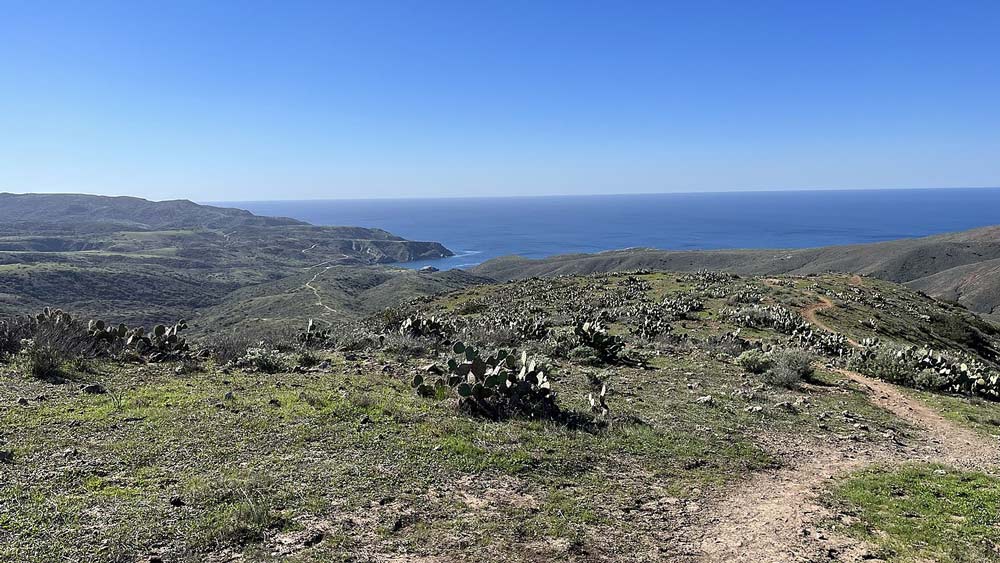
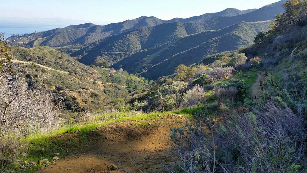
Let’s start with the main trail on Catalina Island that traverses the entire island from Avalon to Two Harbors. This 38.5-mile trail is challenging, both in elevation gain and length. To complete the full hike requires two to five days and the difficulty level is moderate to difficult, with nearly 10,000 feet of total elevation gain.
It is possible to hike parts of the Trans-Catalina Trail, however the official route goes from Avalon in the south to Parsons Landing in the north. The first half of the trail can be challenging with its switchbacks, elevation gain, and unstable surfaces, but after that it’s pretty moderate ridgeline trails.
There are 5 campgrounds you can stay at along the way, 3 of which are beachfront: Hermit Gulch, Blackjack, Shark Harbor, Little Harbor, and Parsons Landing. Along the trail, you’ll get to look out along scenic, hilly terrain, see free-roaming buffalo, pass through the Airport in the Sky, and camp on the beach.
A suggested itinerary for this hike might be:
- Day 1 – 10.7 miles: Avalon to Black Jack campground.
- Day 2 – 8.2 miles: Black Jack to Airport in the Sky and onto Little Harbor campground.
- Day 3 – 5.2 miles: Little Harbor to Two Harbors.
- Day 4 – 7.6 miles: Two Harbors to Parsons Landing
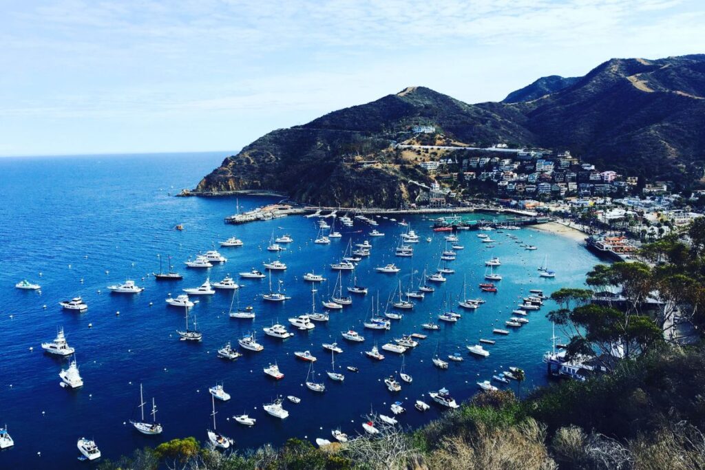
Avalon Bay Trail

The Avalon Bay Trail is great for everyone and can be done in a very short amount of time, so you can fit it into your itinerary easily. In fact, it’s a paved path that accommodates wheelchairs as well. It’s just under a mile and will take about 20 minutes to complete.
The walk takes you along Avalon Bay with great water views, over to Casino Point, where you can eat lunch, do a little shopping, or rent kayaks and paddle boards and get out on the water.
Little Harbor Trail
Little Harbor is a campground on the west side of Catalina, where you’ll find the Little Harbor trailhead. To get to Little Harbor, you can take the shuttle bus. Once there, you can hike to Two Harbors or to Avalon on the Trans-Catalina Trail.
Little Harbor Trail is a 7-mile hike one way to Two Harbors, taking about 5 hours to complete. The Little Harbor Trail begins at the campground and follows Little Harbor Road or Banning House Road all the way to Two Harbors.
The difficulty level of this hike is easy to moderate. The paths are wide, mostly flat, and make for a gentle walk through beautiful forested land. The elevation gain along the route is 1486 ft.
Two Harbors Trails
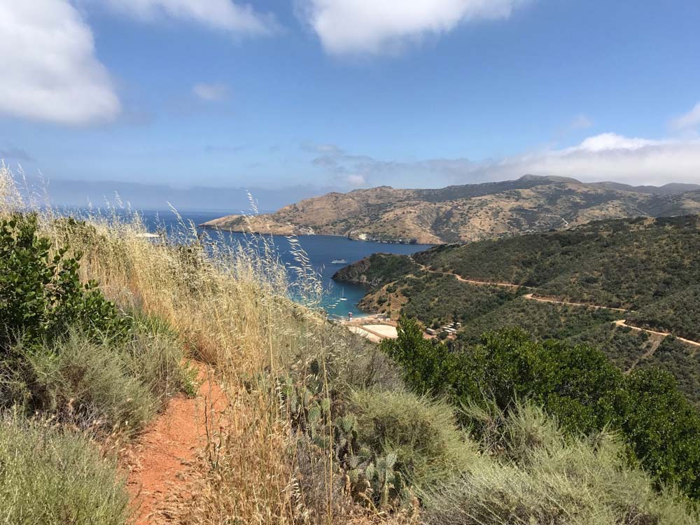
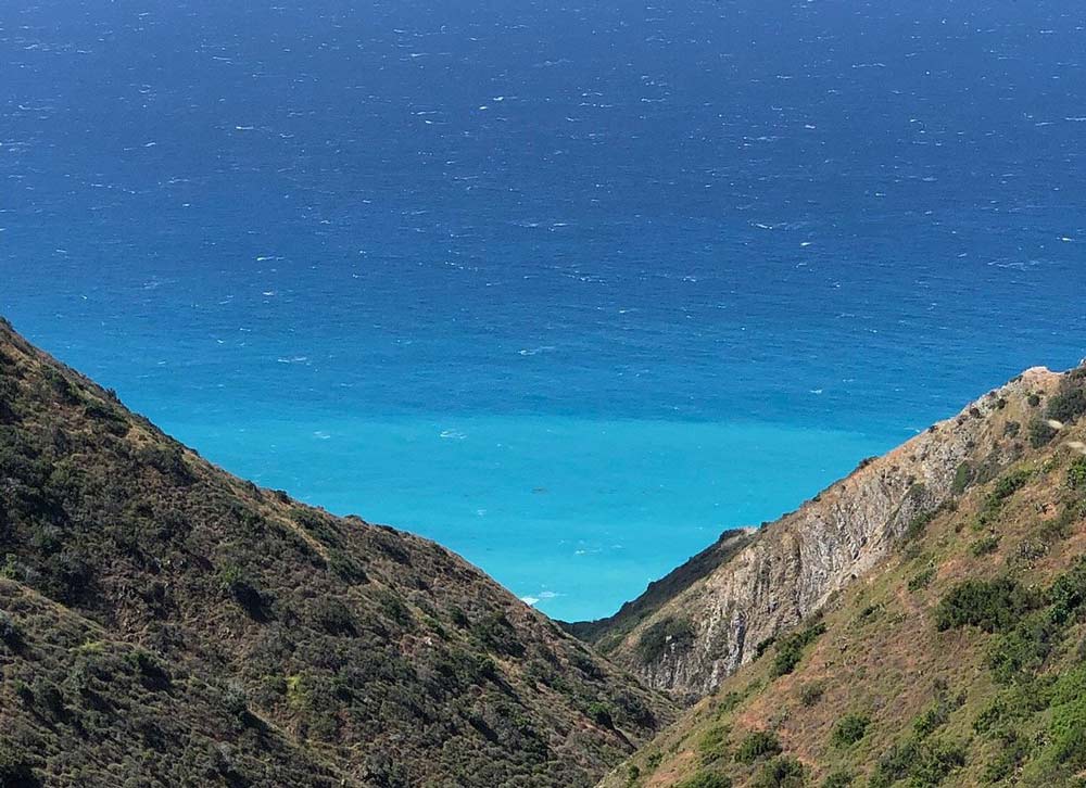
The trails around Two Harbors range from easy to difficult, so hikers of all experience levels can find something to challenge them. A few paths stick to the paved roads already in place, while others wind their way across the hilly landscape and up the rocky peaks. Views of the canyon, the ocean, and the mainland are available from every trail.
You can also get onto the Trans-Catalina Trail in Two Harbors and make the trek down to Avalon or do the hike from Two Harbors to Little Harbor, the reverse of the hike we shared above.
Here are a few of the hikes you can do from Two Harbors:
- Two Harbors to Parsons Landing: 14.6 miles; 6 hours. You can camp at Parsons Landing and hike back the next day. (Moderate)
- Two Harbors to Emerald Bay: 6.6 miles; 4 hours. (Hard)
- Two Harbors to Parsons Beach: 6.8 miles; 4 hours. (Hard)
- Two Harbors Lion Head Loop: 4.9 miles; 3 hours. This hike goes north to Lion Head and Camp Emerald Bay before bearing west and back down to Two Harbors. (Moderate)
- Two Harbors to Sullivan Beach: 8.7 miles; 3:30. (Moderate)
Garden to Sky Trail

This hike is a great one for day trippers. It’s an easy to moderate 2.8-mile loop trail that’s well maintained and well marked. The trail is all uphill until you reach the summit where you’ll have fantastic views over both sides of the island. You can see the other Channel Islands from one side and
To reach the trailhead from Avalon, take Avalon Canyon Road. From the ferry dock, it’s about an hour walk, mostly uphill. You can also take a golf cart, taxi, or trolley to the Wrigley Memorial & Botanic Garden, and begin the hike there, which will make it a 1.2 mile loop.
There is a $7 entrance fee to get into the gardens and to the hiking trail that leads to the summit. You can avoid this fee by hiking the full Garden-to Sky Loop Trail (see below).
Garden-to-Sky Loop Trail
This is an alternative hike up to the Garden-to-Sky Summit, called the Garden-to-Sky Loop Trail. Taking this trail leads you up to the summit, avoiding the fee to get into the botanical garden, but is significantly longer and steeper than the aforementioned Garden-to-Sky Trail.
You access this trail at Hermit Gulch Campground. It’s a 4-mile hike up with a max elevation of 1,561. See the map. The trail immediately begins to climb up from the campground and takes you in and out of the sun, so be sure to lather on the sunscreen.
You will have spectacular views of Avalon Harbor in the distance, then after 2 miles you’ll reach the summit and have spectacular views of both sides of the island. The trail down is the road that descends to the botanical garden.
Hermit Gulch Trail
This 3.4-mile out and back trail takes about 2 hours to complete and is considered a moderate hike, but be prepared for how steep it is. There’s also very little shade. But the views all along the way are well worth the effort. From the summit, you can see both sides of the island.
The trail itself is rocky but well maintained and easy to navigate. It is a gradual incline at the beginning of the trail but then picks up in elevation gain, after the first part it’s smoother sailing.
If you want to lengthen this hike, it’s 8 miles out and back from Avalon, with the end point being Lone Tree Point. There are some more challenging bits on this longer route.
Conclusion
Suppose you want to enjoy one of the most beautiful Islands in California while simultaneously burning a few calories, head on to Catalina Island Hikes.
They offer diverse hiking experiences, ranging from shorter hikes near Avalon with views of Point Vicente Lighthouse to the much longer trails that take around 5 hours round trip but are worth every minute.
Like this article? Save it on Pinterest so you can find it again.
FOLLOW US on Pinterest and Facebook for more California travel inspiration and tips!


Laura is a travel fanatic who loves seeing and doing new things. She lives in Ventura, CA, and spends a lot of time exploring California’s cities, beaches, and national parks.