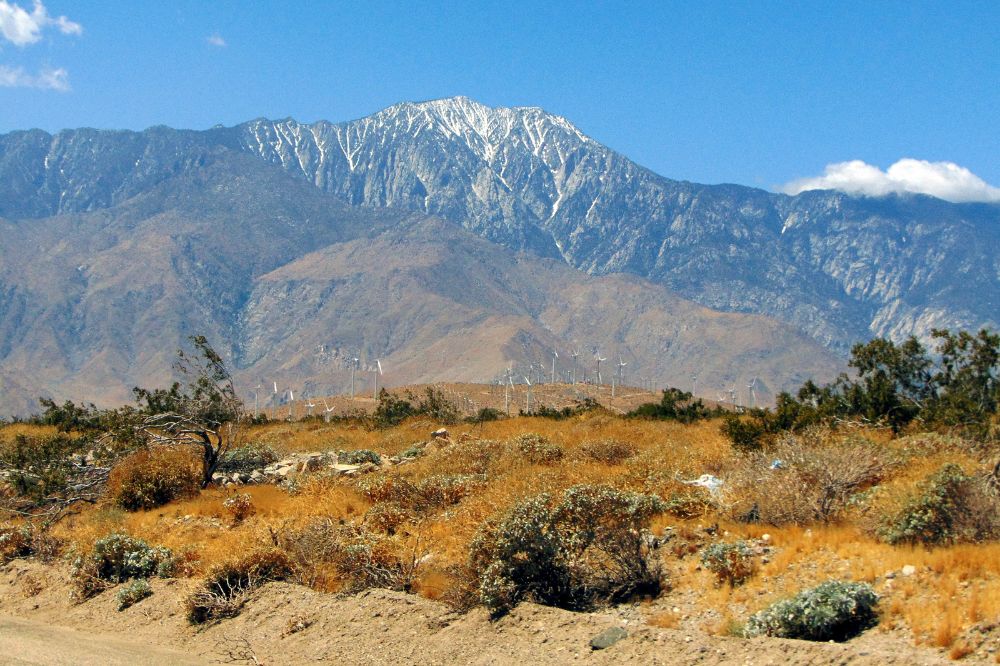
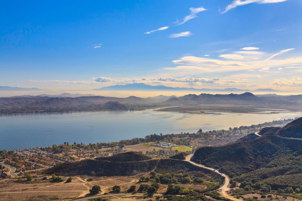
Big Bear Lake is a Southern California treasure. Not only is it an excellent location for fishing, camping, and family summer vacations, it’s also one of the premiere spots in California for hiking.
There are so many trails available around the lake, with amazing views, in all different levels of difficulty, so you can enjoy a hike no matter if you’re a beginner or an expert. Get outside, enjoy the scenery, and experience these Big Bear hiking trails.
» Check out these 15 Top Day Trips From Palm Springs.
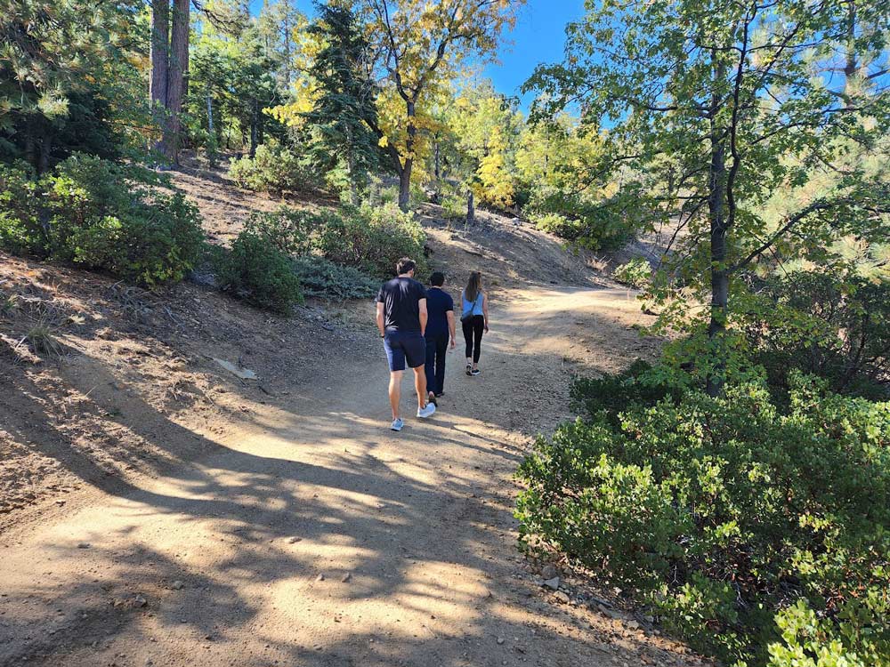
For beginners, you’ll find family-friendly trails around the lake, into the foothills, and along the pine forests. For more advanced hikers, you can tackle one of the more difficult mountain peaks.
Looking for more info on Big Bear? Check out our travel guide to Big Bear, or learn about the top hiking in Big Bear and the top 12 things to do in Big Bear.
Hiking Etiquette
It is essential always to be aware of hiking etiquette, so it is recommended to look up the laws of the land before diving into exploration. Some of which include:
- Do not drive off of established roads.
- Only create campfires in designated areas.
- Do not feed or approach any wildlife.
- Keep your dog on a leash.
- Never leave trash behind.
Where is Big Bear & How to Get There
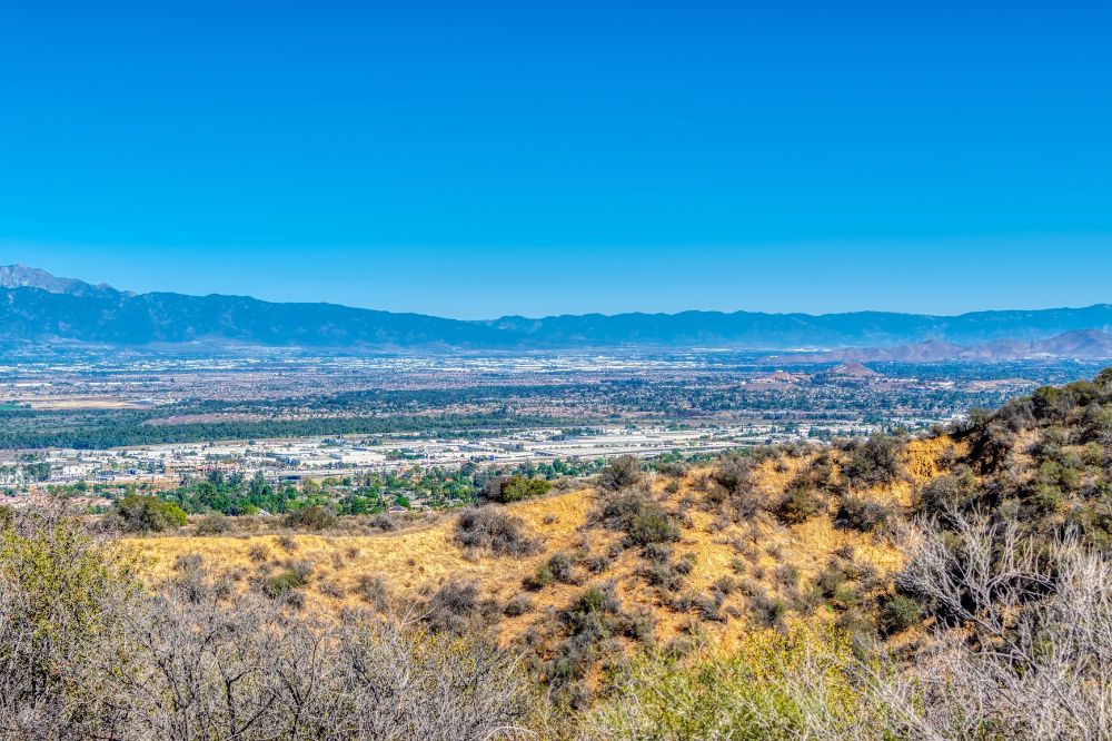
Big Bear is located about 2 hours east of Los Angeles in the San Bernardino National Forest, and it’s the perfect escape from the city, with fresh air, mountains, and forests surrounding you, and over 300 days of sunshine every year.
Because of the alpine freshness and sunshine, Big Bear Lake is a year-round vacation destination that can be enjoyed in all seasons.
You can reach Big Bear from Los Angeles on CA-201, onto CA-330 and CA-18. It’s about 97 miles and takes 2 hours (in good traffic). From San Diego, it’s a 3-hour drive along I-15 and I-215, up to CA-330 and CA-18.
» You might like these 10 Interesting Big Bear Lake Facts.
What You Might Encounter
Hiking in the wilderness has its challenges so there are a few things to prepare for. One being what animals you might encounter along the way.
There are black bears in the Big Bear area, as well as the occasional mountain lion, bobcat, and rattlesnakes. While any of these can pose a threat to hikers, if you’re alert and aware of your surroundings, you can avoid danger by creating a bit of a scene – wave your arms, shout a warning, and slowly back away. For rattlesnakes, try to scan the ground around you as you go.
Don’t Forget Your Pass
An Adventure Pass is required for parking at U.S. Forest Service trailheads and recreation areas, so don’t head out for hiking at Big Bear without it. Daily Passes can be purchased from the Big Bear Visitors Center. You can also use an America the Beautiful (National Park) Pass.
Adventure Passes cost $5/day or $30 for the annual pass and you can buy them with cash or credit card. A day pass is good for the day you purchased it (not for 24 hours). If you plan to stay overnight, you can purchase 2 day passes.
The Top 10 Big Bear Hiking Trails
#1 Castle Rock Trail
- Difficulty: Moderate
- Distance: 4.3 km
- Average time: 1h 30m
- Elevation gain: 250 m
Castle Rock trail is one of Big Bear Lake’s most popular hiking trails and for a good reason. It’s a relatively short hike with excellent tree shade along the way and a breathtaking view at the top.
The trail is a little steep, especially at the beginning, and the terrain is rocky, but overall, it’s a manageable route.
You don’t actually have to climb to the top of Castle Rock to see the view of the lake. Matter of fact, as you near the top of the trail, you’ll be greeted by an incredible view of the lake surrounded by mountains.
A quick tip: If you want to climb to the top of Castle Rock, look for the notch behind the viewpoint; that’s your best bet.
Your doggo can join you on this adventure. Just prepare yourself and your furry friend for some company as this trek is heavily trafficked most of the time.
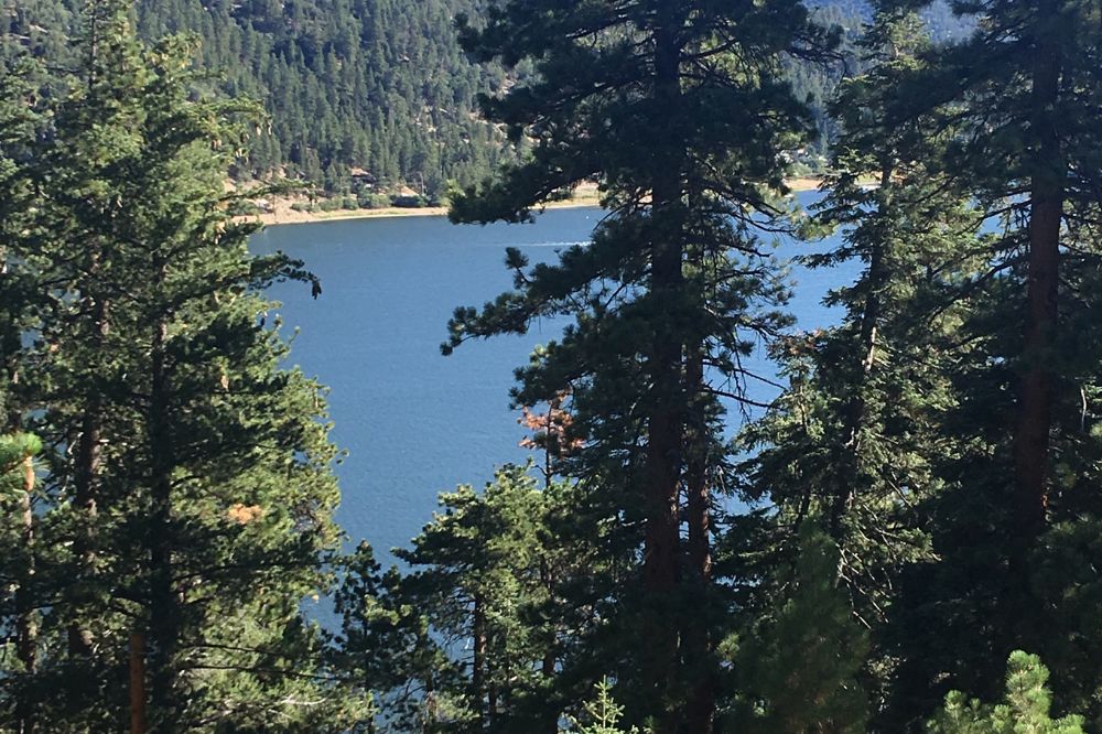
#2 Cougar Crest Trail
- Difficulty: Moderate
- Distance: 9 km
- Average time: 2h 30m
- Elevation gain: 273 m
What’s great about this hike is that you can experience the wilderness and stunning scenery with only moderate effort. You see, the Cougar Crest trail is well maintained and has a gradual incline, so you won’t encounter extreme elevations.
The magnificent Alpine forest will surround you throughout your hike. You’ll also come across an amazing spot with several stone sculptures.
Bertha Peak can even be seen from a distance in the first few miles. This peak is one of the highest points around Big Bear Valley, so getting there will offer you a panoramic view of the lake.
If you want to reach Bertha Peak, simply continue after the Cougar Crest trail. Be aware that the final mile to the summit has a significant elevation gain. Don’t worry, once you see that fabulous scenery, you’ll forget about your aches and pains!
The Cougar Crest trail is fairly straightforward. There’s only one point where the trail transitions from a wide dirt trail to a single track that becomes steeper and rockier at times. However, there are multiple benches along the way where you can sit and relax.
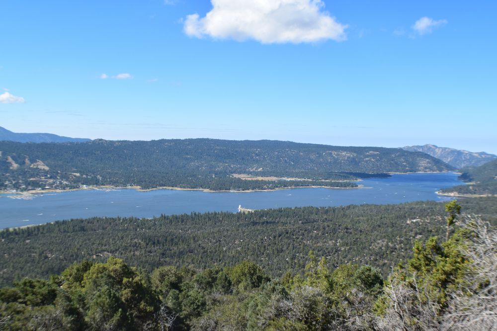
#3 Pine Knot Trail
- Difficulty: Moderate
- Distance: 11.1 km
- Average time: 3h 20m
- Elevation gain: 353 m
The Pine Knot trail is a literal gem, with the entire hike being a sight to behold. To get to the trail, head to Aspen Glen Picnic Area, as it begins there.
Because the trail is well maintained, this area is popular not only for hiking but also for mountain biking and horseback riding.
This isn’t the kind of hike where you climb to the top of a high mountain. Instead, the trail gently ascends within the alpine forest, with a few ups and downs but nothing too strenuous.
As you meander, you’ll witness the beauty of Big Bear Lake and San Gorgonio Mountain. If you continue past the Pine Knot trail, you’ll reach the iconic Grand View Point, which offers a bird’s-eye view of the lake.
The cherry on top is that your dog is welcome on this trail! Just keep him on a leash at all times.
#4 Grays Peak Trail
- Difficulty: Moderate
- Distance: 11.7 km
- Average time: 5h 20m
- Elevation gain: 916 m
This hike is scenic and easy to complete but it’s quite lengthy. You’ll hike through single-track paths and forest service roads as you make your way up to Grays Peak. Nonetheless, you won’t have any trouble finding your way because the trail is well-marked and easy to navigate.
The first few miles will take you through some majestic pines, oaks, and cedar trees. Then you’ll be hiking through some of the damage done by the tragic Butler 2 Fire.
Finally, you’ll get a sweeping view of Big Bear Lake as well as a glimpse of some of the forest’s highest peaks, such as San Gorgonio.
A word of caution: before going, check the Grays Peak trail website for any weather-related closures. Besides, the trail is closed from November 1st to April 1st each year for the bald eagle nesting season.
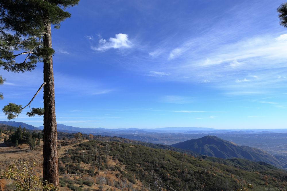
#5 Sugarloaf Mountain Trail
- Difficulty: Challenging
- Distance: 18.7 km
- Average time: 6h 40m
- Elevation gain: 984 m
It’ll take some effort to reach Sugarloaf’s mountain peak, but it’ll be well worth it. Throughout the hike, you’ll enjoy the beautiful landscapes as well as mountain scenery, and your doggo can tag along!
This trek will be steep at times and very rocky at others. However, the beauty of the wilderness will help to alleviate the leg burn; you’ll pass by grand trees, lush meadows, and stunning wildflowers.
As you progress up the trail, high mountain peaks such as San Bernardino, San Gorgonio, and Mt. San Jacinto will begin to appear. One of the best panoramic views of all those peaks is what awaits you at the summit.
#6 Hanna Flat Trail
- Difficulty: Moderate
- Distance: 14.6 km
- Average time: 3h 40m
- Elevation gain: 337 m
No doubt Hanna Flat trail offers an unmatched sense of tranquility. It isn’t as well-known as other destinations because it doesn’t provide panoramic views, but it’s still worth a hike.
The hike will start at the Grays Peak trailhead and will then take you away from the crowds and into the serene Hanna Flat.
You’ll mostly be climbing uphill through rugged terrain, where you’ll be treated to a variety of captivating landscapes. You’ll see meadows, unusually stacked rocks, alpine forests, low shrubland, and a lot more.
Just keep in mind that it’ll be closed during the bald eagle nesting season, just like the Grays trail.
#7 John Bull Loop Trail
- Difficulty: Moderate
- Distance: 12.6 km
- Average time: 3h 15m
- Elevation gain: 282 m
The John Bull loop starts at Van Dusen Canyon road and is a mesmerizing trail that is accessible all year long.
It’s unlikely to have any trouble hiking this trail, yet it’s quite difficult to bike. It’s riddled with rocks and boulders, so navigating a bike through it requires stamina and a high level of skill.
The majority of the trail is gravel, with a parallel narrow dirt road for those who prefer it. While hiking you’ll see many spectacular spots and views.
You’ll pass through the historic Holcomb Valley, which is home to the majority of Southern California’s gold mines. You’ll also be surrounded by wildflowers and majestic trees in enchanting landscapes.
At the top, you’ll be rewarded with a gorgeous view of Pardee Reservoir, as well as a bench to sit on and enjoy the scenery.
#8 Alpine Pedal Path Trail
- Difficulty: Easy
- Distance: 8.4 km
- Average time: 1h 50m
- Elevation gain: 91 m
This trail is ideal for hikes with families or anyone looking for a casual hike with delightful views. Plus, no bikes or dogs should be left behind; both are welcome on this trail!
The Alpine Pedal Path is a paved route that runs along Big Bear Lake’s north shore. As you hike the trail, you’ll get close-up views of the lake and mountains. You’ll also pass by bright meadows and picnic areas where you can sit and enjoy a snack.
The road will then take you through the pine forest along the Serrano Campground’s border. If you continue on the unpaved path, you’ll arrive at a lovely beach along the lake.
#9 Butler Peak Trail
- Difficulty: Moderate
- Distance: 16.1 km
- Average time: 4h 30m
- Elevation gain: 467 m
Going up Butler Peak is one of these hikes that end with 360-degree epic views. After all, it’s the highest mountain top fire lookout in Front Country Ranger Districts!
Your hike will feature numerous scenery changes. Beautiful low-lying shrubs and alpine trees will be your walking companions. Besides, your doggo can join in with a leash!
When you get to the top, you’ll see the cool fire lookout tower and have an incredible view of Big Bear Lake, Inland Empire, Apple Valley, and San Gorgonio Peak. While you’re up there, don’t forget to look at the Osborne Fire Finder, a vintage instrument used to locate wildfires.
Be aware that due to snow accumulation, the road leading to the trail is closed from winter to spring.
#10 Siberia Creek Trail
- Difficulty: Challenging
- Distance: 29.3 km
- Average time: 10h 50m
- Elevation gain: 1,618 m
Another challenging but worthwhile hike is Siberia Creek. It’s a fantastic destination for not only hiking but also camping and fishing.
As you wander through this trail, you’ll get lost in the dense forest filled with a variety of trees and wildflowers. We’re talking about massive Lodgepole and Ponderosa Pine trees with base diameters of 22″, as well as cheerful meadows.
As you near the summit, you’ll start seeing dazzling views of Palomar Mountain and Saddleback Mountain above Lake Elsinore. The exciting part is that on a clear day, you might catch a glimpse of the ocean!
If your pooch is in good shape, prepare him for this trek; he’s welcome to come along on a leash.
Final Word
Knowing the best hikes in Big Bear is the first step toward an unforgettable adventure!
Before going to any of those trails, check to see if parking passes are required and the condition of the lot. For example, Castle Rock doesn’t provide parking; instead, you should park on the opposite side of the highway, so it’s best to leave your car at home.
» Find the perfect hiking clothes. I love these weather resistant, breathable shorts by Arcteryx (for women | for men) paired with a light performance shirt (for women | for men).
Like this article? Save it on Pinterest so you can find it again.
FOLLOW US on Pinterest and Facebook for more California travel inspiration and tips!


Laura is a travel fanatic who loves seeing and doing new things. She lives in Ventura, CA, and spends a lot of time exploring California’s cities, beaches, and national parks.